
Opole Districts - Interactive Map & Guide
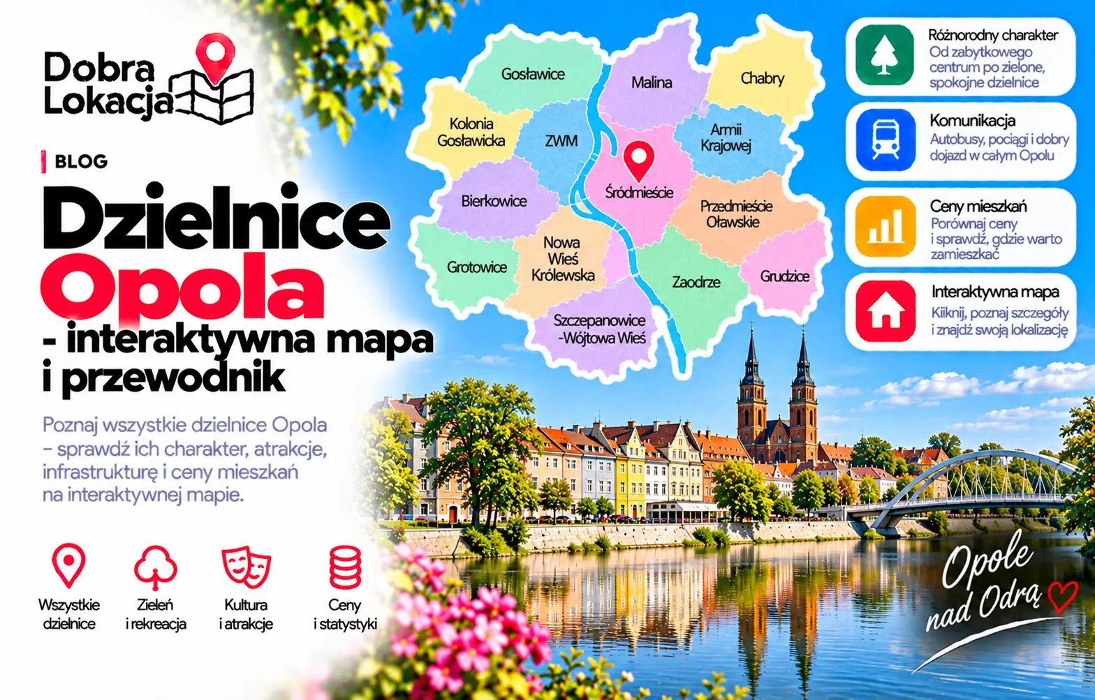
Explore Opole districts and neighbourhoods on an interactive map. Compare the centre, Zaodrze, Chabry, Gosławice and other areas before buying or renting a home.
Interactive district map
Centre and riverside areas
Consider central Opole if access to services, culture and city attractions matters to you. Before choosing a home, check street traffic, parking and walking routes to everyday destinations.
Zaodrze and Szczepanowice
When comparing the western part of the city, check your route across the Oder to work or school. Walkable stops and services may matter more than distance to the centre alone.
Chabry, Gosławice and Kolonia Gosławicka
Compare schools, shops, transport and walking areas. Housing types and access to services can change between neighbouring streets, so assess the exact address.
Outskirts and choosing a location
Compare Grudzice, Malina, Grotowice and Bierkowice against your priorities: greenery, space and daily journeys. Check current listings of similar size and condition and visit the area at different times of day.
District overview
Armii Krajowej
Block estate with schools and shops
Bierkowice
Bierkowice - an Opole district with its own character and local infrastructure
Borki
Borki - an Opole district with its own character and local infrastructure
Brzezie
Brzezie - an Opole district with its own character and local infrastructure
Chabry
Popular block estate near the centre
Chmielowice
Chmielowice - an Opole district with its own character and local infrastructure
Czarnowąsy
Suburban village with houses and greenery in the north
Gosławice
Estate of houses and new blocks in the east
Groszowice
House district on the Oder in the south
Grotowice
Grotowice - an Opole district with its own character and local infrastructure
Grudzice
Quiet house estate in the south-east
Kolonia Gosławicka
Estate of blocks and houses in the east
Krzanowice
Krzanowice - an Opole district with its own character and local infrastructure
Malina
Suburban house estate in the west
Malinka
Southern block estate with good transport
Nadodrze
District on the Oder with mixed housing
Nowa Wieś Królewska
Nowa Wieś Królewska - an Opole district with its own character and local infrastructure
Półwieś
House estate with greenery near the centre
Stare Miasto
Historic part of the city with tenements on the Oder
Szczepanowice - Wójtowa Wieś
Estate of houses and blocks near hospitals
Sławice
Sławice - an Opole district with its own character and local infrastructure
Winów
Winów - an Opole district with its own character and local infrastructure
Wrzoski
Wrzoski - an Opole district with its own character and local infrastructure
Wróblin
Wróblin - an Opole district with its own character and local infrastructure
Zakrzów
Zakrzów - an Opole district with its own character and local infrastructure
Zaodrze
Large block district across the Oder with full amenities
Śródmieście
City centre: Market Square, town hall, Pasieka Island and shops
Świerkle
Świerkle - an Opole district with its own character and local infrastructure
Żerkowice
Żerkowice - an Opole district with its own character and local infrastructure
Check an address on the map
Explore Opole districts and neighbourhoods on an interactive map. Compare the centre, Zaodrze, Chabry, Gosławice and other areas before buying or renting a home.
Check an address on the map