
Olsztyn Districts - Interactive Map & Guide
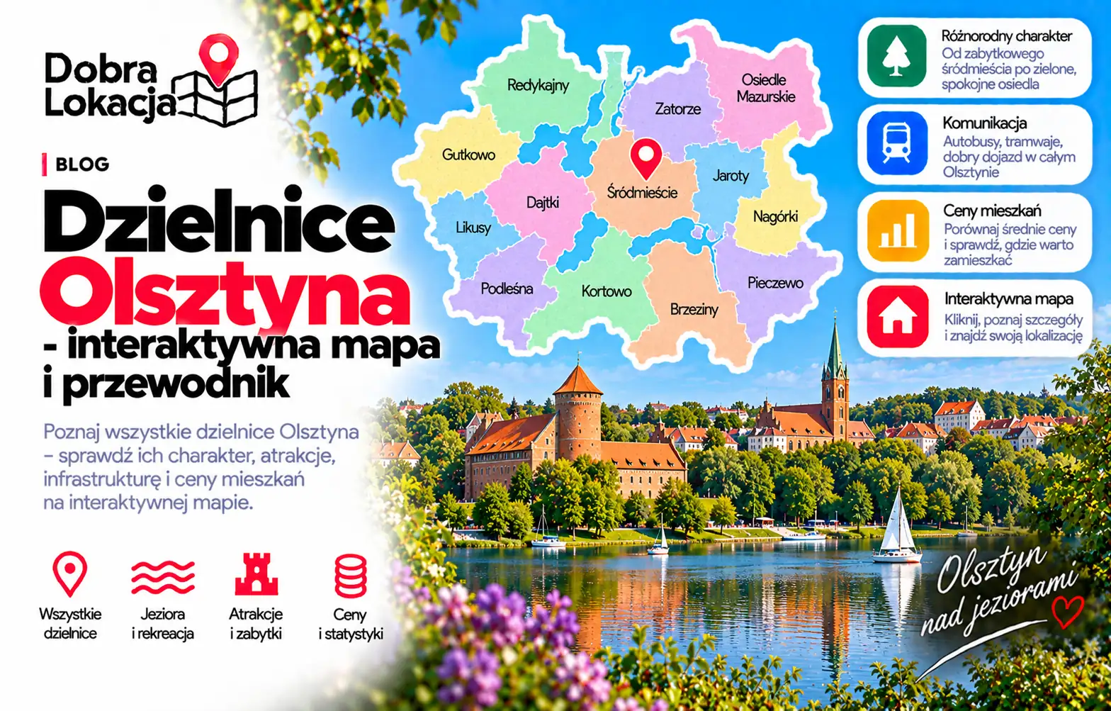
Explore Olsztyn neighbourhoods and compare their location and character, from Śródmieście to Jaroty, Kortowo, Dajtki and Gutkowo. Use the map to explore an area before buying or renting a home.
Interactive neighbourhood map
Centre and everyday services
Consider Śródmieście and nearby areas if access to services and city attractions matters to you. Check traffic on the main street, parking and your route to work before choosing an address.
Jaroty, Nagórki and Pieczewo
In the south, compare tram and bus connections, schools and shops. Everyday convenience depends on the exact street and distance to a stop, rather than the neighbourhood name alone.
Kortowo and the lakes
Kortowo is associated with the university campus and Lake Kortowskie. Compare Dajtki, Likusy and Gutkowo if recreation and greenery are priorities. Also check the journey time to your everyday destinations.
Comparing locations
Compare transport, schools, services and walking routes for each address. Check current property listings of similar size and condition. Visit in the morning and evening to assess noise and parking.
Neighbourhood overview
Brzeziny
Quiet single-family housing area in the north
Dajtki
Green house estate by Lake Ukiel, close to the forest
Generałów
Estate of blocks and houses in the southern part
Grunwaldzkie
District next to the centre with tenements and good transport
Gutkowo
Suburban estate of new houses in the west
Jaroty
Largest block estate with full amenities and tram
Kormoran
Block estate with schools and shops near the centre
Kortowo
University of Warmia and Mazury campus by Lake Kortowskie
Likusy
Quiet house estate on the outskirts with lots of greenery
Osiedle Kętrzyńskiego
Estate near the centre with mixed housing
Osiedle Tadeusza Kościuszki
Block estate close to the centre and station
Podgrodzie
Block estate near the Old Town and Łyna valley
Podleśna
Estate by the City Forest, quiet and green
Wojska Polskiego
Estate by the City Forest with blocks and houses
Zatorze
District beyond the railway with tenements and blocks
Zielona Górka
Green estate of houses and new blocks in the east
Śródmieście
City centre: Old Town, castle, town hall and shops
Check an address on the map
Explore Olsztyn neighbourhoods and compare their location and character, from Śródmieście to Jaroty, Kortowo, Dajtki and Gutkowo. Use the map to explore an area before buying or renting a home.
Check an address on the map