
Częstochowa Districts - Interactive Map & Guide
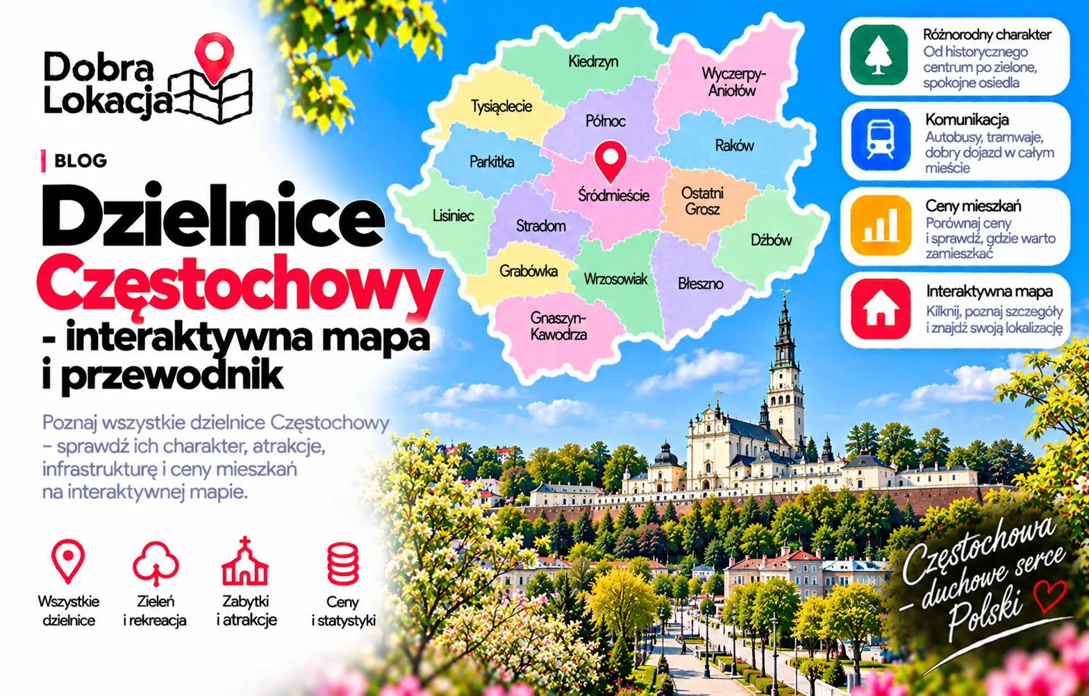
Explore Częstochowa districts on an interactive map. Compare Śródmieście, Tysiąclecie, Północ, Parkitka, Raków and other areas before buying or renting a home.
Interactive district map
Centre and Śródmieście
When choosing a central home, compare access to services, the station and everyday destinations. City attractions can be an advantage, but check street traffic, noise and parking around the exact building.
Tysiąclecie, Północ and Parkitka
Compare these districts by schools, shops, walking areas and transport connections. A district name alone does not determine convenience: distance to a stop and actual journey times matter.
Raków, Wrzosowiak and the south
When comparing Raków, Wrzosowiak, Błeszno and nearby areas, check your commute and access to trams and buses. Look at walkable services and the surroundings of the exact street.
Quieter areas and choosing a home
Compare Lisiniec, Grabówka, Kiedrzyn and Stradom against your priorities: greenery, housing type and daily travel. Check prices using current listings of comparable size and condition. Visit in the morning and evening.
District overview
Błeszno
House and block estate in the south, near forests
Częstochówka-Parkitka
Quiet district of houses and blocks in the west
Dźbów
House estate with lots of greenery in the north-east
Gnaszyn-Kawodrza
Suburban single-family district in the west
Grabówka
Quiet house estate on the outskirts
Kiedrzyn
Green house district in the north
Lisiniec
House estate by Lisiniec Park and ponds
Mirów
Mixed industrial-residential district on the Warta
Ostatni Grosz
Small block estate near the centre
Podjasnogórska
District next to Jasna Góra with parks
Północ
Large block estate with full amenities
Raków
Historic working-class district with blocks and steelworks
Stare Miasto
Old Town with tenements and good transport
Stradom
District by Stradom station with blocks and houses
Trzech Wieszczów
Block estate near the centre with schools and shops
Tysiąclecie
Block estate with parks and good amenities
Wrzosowiak
Southern block estate with tram
Wyczerpy-Aniołów
District of houses and industry in the east
Zawodzie-Dąbie
District of houses and blocks on the Warta
Śródmieście
City centre: NMP avenues, shops and services
Check an address on the map
Explore Częstochowa districts on an interactive map. Compare Śródmieście, Tysiąclecie, Północ, Parkitka, Raków and other areas before buying or renting a home.
Check an address on the map