
Bydgoszcz Districts - Interactive Map & Guide
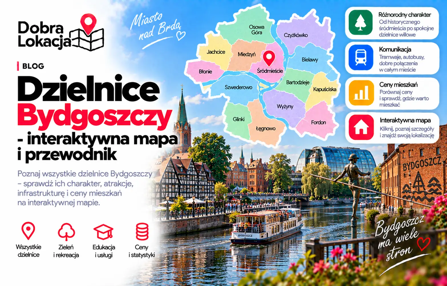
Bydgoszcz has very different neighbourhoods: the historic centre by the Brda, green Leśne and Bielawy, block estates such as Bartodzieje, Wyżyny and Kapuściska, quiet Miedzyń-Prądy and the large Fordon area. This interactive map helps compare their character, area and estimated population.
Interactive map of Bydgoszcz districts
Click a neighbourhood on the map or select it from the list. You will see its character, estimated population and area.
Select a neighbourhood:
Bydgoszcz districts overview
Below are all Bydgoszcz neighbourhoods from the districts layer, useful for comparing apartment locations.
Bielawy
Quiet neighbourhood near the centre, low-rise housing and greenery
Bartodzieje
Large block estate with schools, retail and good transport
Brdyujście
Recreational areas by the regatta course and the mouth of the Brda
Bydgoszcz Wschód - Siernieczek
Eastern part of the city, mixed housing by the railway and the Brda
Osowa Góra
Western family neighbourhood with forests and full infrastructure
Flisy
Small neighbourhood by the canal with plenty of greenery
Czyżkówko
Single-family neighbourhood by the Bydgoszcz Canal
Okole
Tenements by the Brda and the Bydgoszcz Canal, near the centre
Wilczak-Jary
Mixed housing in the north, close to green areas
Smukała - Opławiec - Janowo
The greenest, resort-like outskirts along the Brda
Piaski
Peripheral neighbourhood with single-family homes and forests
Jachcice
Northern riverside part of the city, low-rise housing and greenery
Miedzyń-Prądy
Western single-family neighbourhoods: quiet and spacious
Leśne
Green, prestigious villa district right next to Gdański Forest
Bocianowo-Śródmieście-Stare Miasto
Historic centre with Mill Island, the Old Market Square and full services
Nowy Fordon
Bydgoszcz's largest dormitory area: blocks, schools and a fast tram
Tatrzańskie
Compact block estate near Fordon and the main exit roads
Terenów Nadwiślańskich
Vistula-side green and recreational areas in the east of the city
Stary Fordon
A former town on the Vistula with a historic market and boulevards
Błonie
Quiet residential neighbourhood with greenery and local retail
Górzyskowo
Single-family housing on the hill, a quiet area
Szwederowo
Densely populated hilltop neighbourhood overlooking the centre
Glinki-Rupienica
The south: blocks and single-family homes near the ring road
Wyżyny
Panel-block estate with full infrastructure and a tram line
Wzgórze Wolności
Block estate with services, schools and good access to the centre
Kapuściska
Large residential estate in the south, close to industrial areas
Zimne Wody - Czersko Polskie
Industrial and port areas with limited residential housing
Łęgnowo-Wieś
Suburban character in the south-east: houses and fields
Łęgnowo
Workers' estate next to industrial areas, surrounded by forests
District character
Centre and the Brda area
Bocianowo-Śródmieście-Stare Miasto, Okole and Bielawy give the best access to services, culture, universities and riverside areas. They suit urban lifestyles, but noise and building condition should be checked carefully.
Block estates and practical transport
Bartodzieje, Wyżyny, Kapuściska, Wzgórze Wolności and Szwederowo are practical for everyday life, with schools, shops, trams and buses. They differ in greenery, density and commute times.
West and villa districts
Osowa Góra, Miedzyń-Prądy, Czyżkówko, Jachcice and Leśne offer more calm, greenery and single-family housing. They are strong for families, but transport details matter.
Fordon and the east
Nowy Fordon and Stary Fordon form a large eastern part of Bydgoszcz. They are more self-contained, with tram access and the Vistula nearby, but the commute to the centre depends on the exact address.
Check a specific location in Bydgoszcz
The district is only the first step. Enter an exact address and check transport, greenery, schools, services and everyday comfort.
Open location map