
Białystok Districts - Interactive Map & Guide
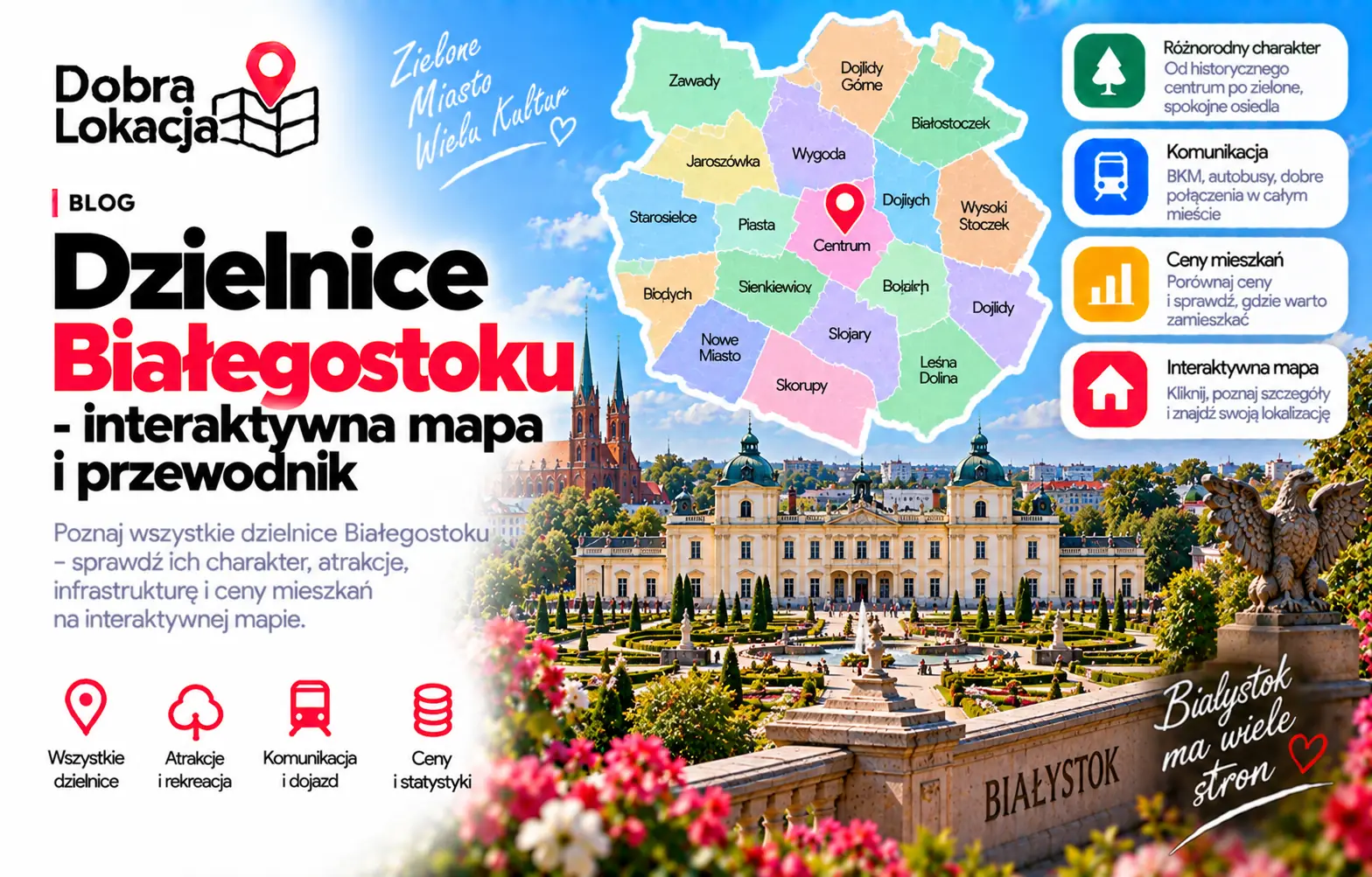
Białystok has a readable urban structure: services, culture and transport concentrate in the centre, calmer Bojary, Piaski and Sienkiewicza sit nearby, while larger housing estates and greener edge districts spread around them. This interactive map helps compare each area's location, scale and character.
Interactive map of Białystok districts
Click a neighbourhood on the map or select it from the list. You will see its character, estimated population and area.
Select a neighbourhood:
Białystok districts overview
Below are all Białystok districts from the district layer, useful for comparing apartment locations.
Piasta I
Piasta I - a Białystok district with its own character and local infrastructure
Piasta II
Piasta II - a Białystok district with its own character and local infrastructure
Bojary
Historic district of wooden houses next to the centre, quiet and green
Sienkiewicza
Sienkiewicza - a Białystok district with its own character and local infrastructure
Bema
Bema - a Białystok district with its own character and local infrastructure
Białostoczek
Intimate district near the centre with mixed housing
Centrum
City centre: Kościuszko Market Square, Lipowa street, offices, cafes and full transport
Przydworcowe
Area around the railway station with good regional transport
Mickiewicza
Mickiewicza - a Białystok district with its own character and local infrastructure
Piaski
Inner-city district within walking distance of the Planty park and Branicki Palace
Kawaleryjskie
Kawaleryjskie - a Białystok district with its own character and local infrastructure
Nowe Miasto
Large block estate with good amenities, schools and Zwierzyniecki Forest nearby
Zielone Wzgórza
Modern estate with plenty of greenery and new developments
Leśna Dolina
Green block estate by the forest, popular with families
Starosielce
Former separate village with its own railway station and houses
Słoneczny Stok
Quiet estate of single-family houses and blocks in the south
Młodych
Młodych - a Białystok district with its own character and local infrastructure
Wysoki Stoczek
Popular block estate in the north with good transport and services
Antoniuk
Extensive estate with blocks and houses, shops and schools on site
Bacieczki
Bacieczki - a Białystok district with its own character and local infrastructure
Dziesięciny I
Block estate with full amenities and quick access to the centre
Dziesięciny II
Mixed estate of blocks and single-family houses in the north
Zawady
Zawady - a Białystok district with its own character and local infrastructure
Jaroszówka
Jaroszówka - a Białystok district with its own character and local infrastructure
Skorupy
Skorupy - a Białystok district with its own character and local infrastructure
Wygoda
Wygoda - a Białystok district with its own character and local infrastructure
Dojlidy Górne
Dojlidy Górne - a Białystok district with its own character and local infrastructure
Dojlidy
District with Dojlidy reservoir, forests and recreation, many houses
Bagnówka
Bagnówka - a Białystok district with its own character and local infrastructure
District character
Centrum, Bojary and Piaski
Centrum, Bojary, Piaski, Sienkiewicza and Przydworcowe offer the strongest access to services, offices, cafes, universities and public transport. They are the most urban parts of Białystok, but noise, parking and traffic near main streets should be checked address by address.
Large residential estates
Nowe Miasto, Antoniuk, Wysoki Stoczek, Dziesięciny I, Dziesięciny II, Zielone Wzgórza and Leśna Dolina are practical for everyday life, with shops, schools, stops and many apartments. They differ in density, greenery and travel time to the centre.
East and south
Dojlidy, Dojlidy Górne, Skorupy, Bagnówka, Mickiewicza and Kawaleryjskie are more varied: from recreation areas and detached houses to neighbourhoods closer to the inner city. Exact transport links matter here.
North and outskirts
Bacieczki, Starosielce, Zawady, Jaroszówka, Wygoda, Białostoczek, Słoneczny Stok and Młodych offer a calmer rhythm, more greenery or a stronger local character. The right choice depends on commute, schools, services and access to recreation.
Check a specific location in Białystok
The district is only the first step. Enter an exact address and check transport, greenery, schools, services and everyday comfort.
Open location map